To support London’s population growth and its increased demands on the city’s transportation system, the Borough of Kingston has taken on the task to transform the rail station’s entrance square into an appealing, intermodal hub, while promoting sustainable mobility throughout the borough. Responding to the city’s “Go Cycle” program, our multi-disciplinary team devised an integrated proposal that optimised and improved the pedestrian and cycling experience, facilitated slow mobility to and from the rail station and reconnected the city centre to the river Thames.
The Upton and Raynham residential development aims to deliver an ambitious scheme for affordable housing in London, combined with a welcoming, inclusive and enjoyable outdoor environment. By prioritising a pedestrian-friendly public space, our plan not only improves liveability for current and future residents but also contributes to making the neighbourhood climate-adaptive and nature-inclusive.
Once known as Brink park, the area in Apeldoorn, despite its name, was far from the green oasis it implied. Instead, it was a stony car park that concealed the original landscape, disconnecting the city from its natural heritage and the existing brook was running in a tube underground. In a remarkable transformation, the concept of the landscape was inverted, paving the way for an underground parking facility and the revival of the Grift brook, making it visible once again. This approach resulted in a place that alludes to a local type of brook valley, placed right in the heart of Apeldoorn. A solution that made the city regain its connection to the characteristic landscape of the area.
Meridian Water serves as an example of a landscape-led masterplan, utilising the pre-existing network of brooks and canals as the backbone for a new high-density urban development. Through the strategic integration of local green and blue assets, we have crafted a robust framework that effectively mitigates flood risks threatening the area. This approach sets a visionary precedent for urban developments in the 21st century.
The centre of Gullegem is undergoing an inspiring transformation. A combined intervention will provide the area with more space for residents and their activities. It also strengthens the character and identity of the place. However, above all it focuses on creating more space for nature. This creates a future-proof dynamic climate-adaptive heart of the village.
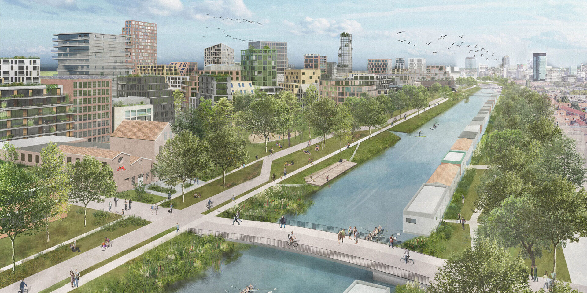
The rapid growth of Utrecht requires highly sustainable development that can accommodate contemporary lifestyles and address the challenges posed by climate change. The eastern flank of the Kanaleneiland is currently undergoing redevelopment with these crucial goals in mind. Covering an expansive area of 24 hectares and expected to house approximately 12,000 residents, Merwedekanaalzone, sub-area 05, currently stands as the largest development zone. Given the size of the project, and the ambitious objectives set by the municipality of Utrecht, a unique opportunity arises to create an innovative district unlike any other.
Domplein, located in the heart of Utrecht, hides the treasure of 2000 years of urban history beneath the surface of the square, waiting to be discovered. By dynamically marking the historical Castellum, which now rests 4 meters below ground, we make history visible and accessible in an exciting and contemporary manner.
Hattem is a characteristic small, fortified town, located between the forests of the Veluwe area and the IJssel river. As a part of the medieval Hanseatic trade league, the city is graced with a picturesque historical appearance with listed buildings and cityscapes. The combination of the two attractive landscapes, the picturesque quality of the city itself and three museums, makes Hattem a popular tourist destination.
Bellamy park’s rich history means the place has already seen many faces, from harbour to car park. Its size and central location in the city made it attractive as an events square. At the same time, there was also an opportunity to make the square more attractive and greener, thus doing more justice to its name as a park. Our design provided a better fit of the urban scale and context and arranged Bellamy park in a way that did justice to both the history of the place and its contemporary role.
Rich history
Walking on Bellamy park is walking on historic grounds. When the Spanish chief architect Don Pacheo arrived in the city carrying a death list of people living in Vlissingen, he was immediately imprisoned at Bellamy park. A stone in the pavement reminds us of this event that was part of Vlissingen history, being the first city to liberate themselves from the Spanish during the Dutch 80-year liberation war. Because of its strategic position, Vlissingen always was a focal point during the wars, including during the Second World War, when the city was heavily bombed.
Balancing out qualities
We were inspired by the layers of history, which present themselves in the urban layout of the city, via a sequence of harbours. In the historic heart of Vlissingen, Bellamy park originated after the harbour of Koopmanshaven and was filled in at the beginning of the 20th century. A contemporary reinterpretation of the former space transforms the elongated setting, which used to be dominated by cars and parking lots, into a hybrid public space with both park and square characteristics. The design challenge was to rediscover a scale that matched the architecture and intended use of the place and to allow the space to host frequent small events and larger annual events like the Liberation Festival on 5 May, whilst being a space that is inviting to stay, even on the days when there are no events.
Restored sense of scale
We restored the balance with a square that facilitates various forms of urban use while simultaneously telling its own spatial and historical story. In this elongated space, a transition was made from a spacious square, designed for use by the hospitality industry, to a more intimate park-like place where blooming planting beds divide the space and offer a recreational quality. The clear layout makes the structure of the space readable again. It is distinctly a contemporary square with an eye on history.
A relaxing, lively square
Thanks to movable furniture and planting beds, the space can be flexibly arranged. This makes the stay pleasant on weekdays, while also allowing for a lot of space to be made available for events. The edges of the square have been given a new profile, considering the various functions behind the surrounding facades. There is now – where needed – ample space for terraces, supplies and strolling pedestrians. Every aspect has found its optimal place. This way, the square quality and the park quality of the place are combined. Bellamy park can thus serve as both a green and attractive place throughout the year as well as an event square; Bellamy park has now been embraced as the bustling heart of Vlissingen’s nightlife. During the summer months, the park is filled with cozy terraces and serves as the venue for many of the festivals and events held in Vlissingen. Bellamy park has now been embraced as the bustling heart of Vlissingen’s nightlife.