April 2, 2026 News


In an interdisciplinary collaboration with the hydrological agency Nelen and Schuurmans, we have developed an integrated blue-green approach in three vulnerable districts of Antwerp: Struisbeek, Merksem-West, and Morkhoven Groenenhoek. This tailor-made methodology will be implemented in phases over the coming years through street projects and maintenance.


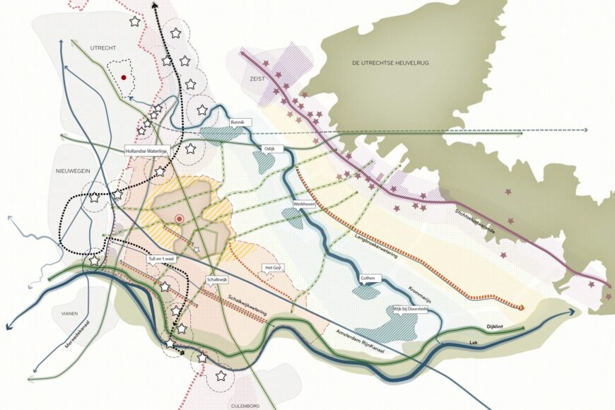
The historic east-west oriented drainage structure with the three natural streams has been disrupted by land reclamation, urbanization, canalization, and roofing into wide, largely paved roads
Using the ‘Rekenen en Tekenen’ process (translated as ‘Calculating and Drawing’) with Nelen & Schuurmans, we quantified the climate adaptation challenge and assessed the proposed measures. This work alternated with an integrated design approach that embedded these measures into the neighbourhood to reinforce its spatial structure. A resulting combination of measures aims to make the neighbourhoods future-proof, demonstrating the uniqueness and success of the collaboration.
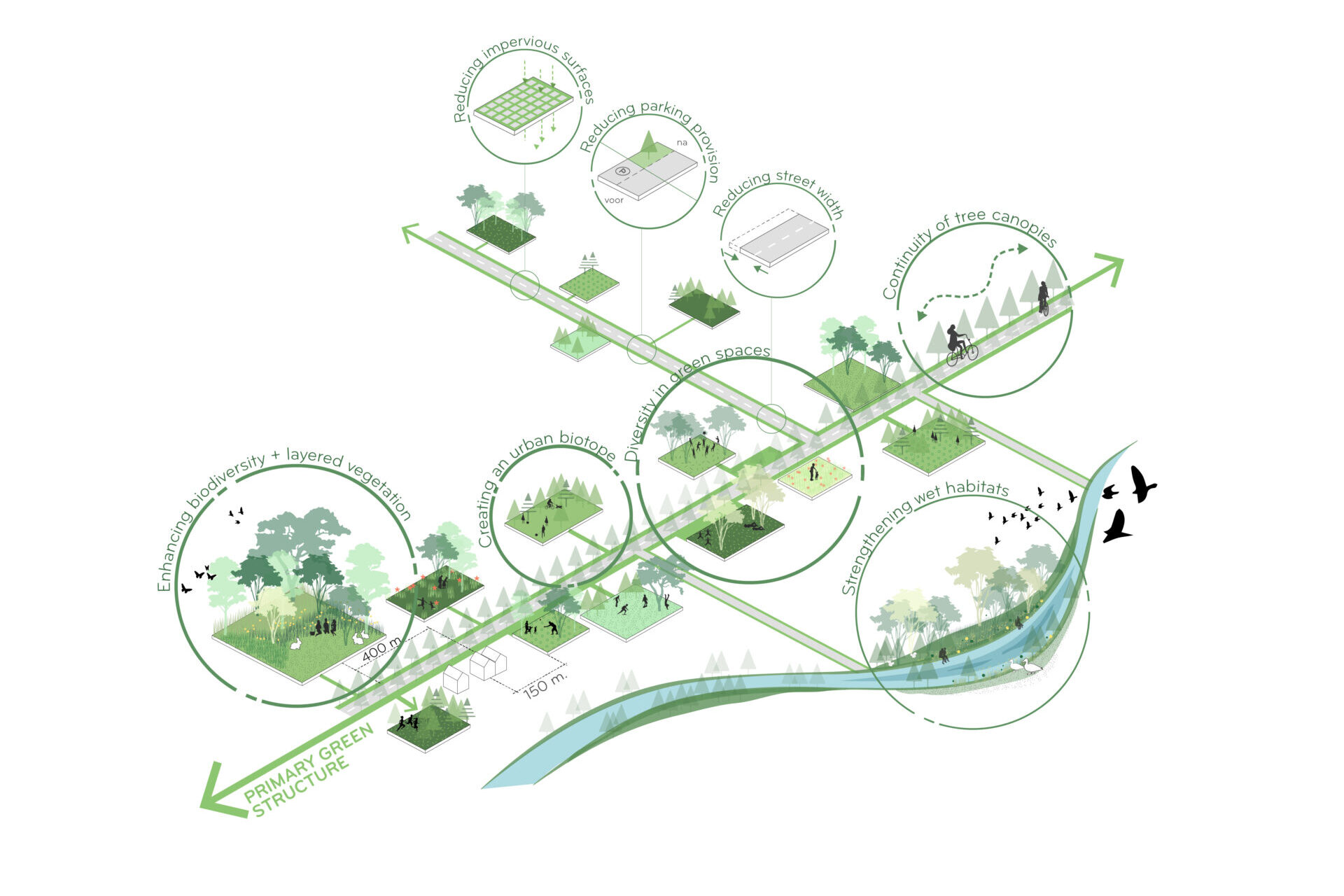
The most effective measures, composed of distinct green-blue typologies, builds on the district’s historical spatial characteristics and addresses key challenges related to flooding, drought, heat, greenery, and ecological networks. It also reinforces the spatial framework—linking parks, post-war city roads, former stream corridors, and tree-lined residential streets—while strengthening the neighborhood’s overall green identity.


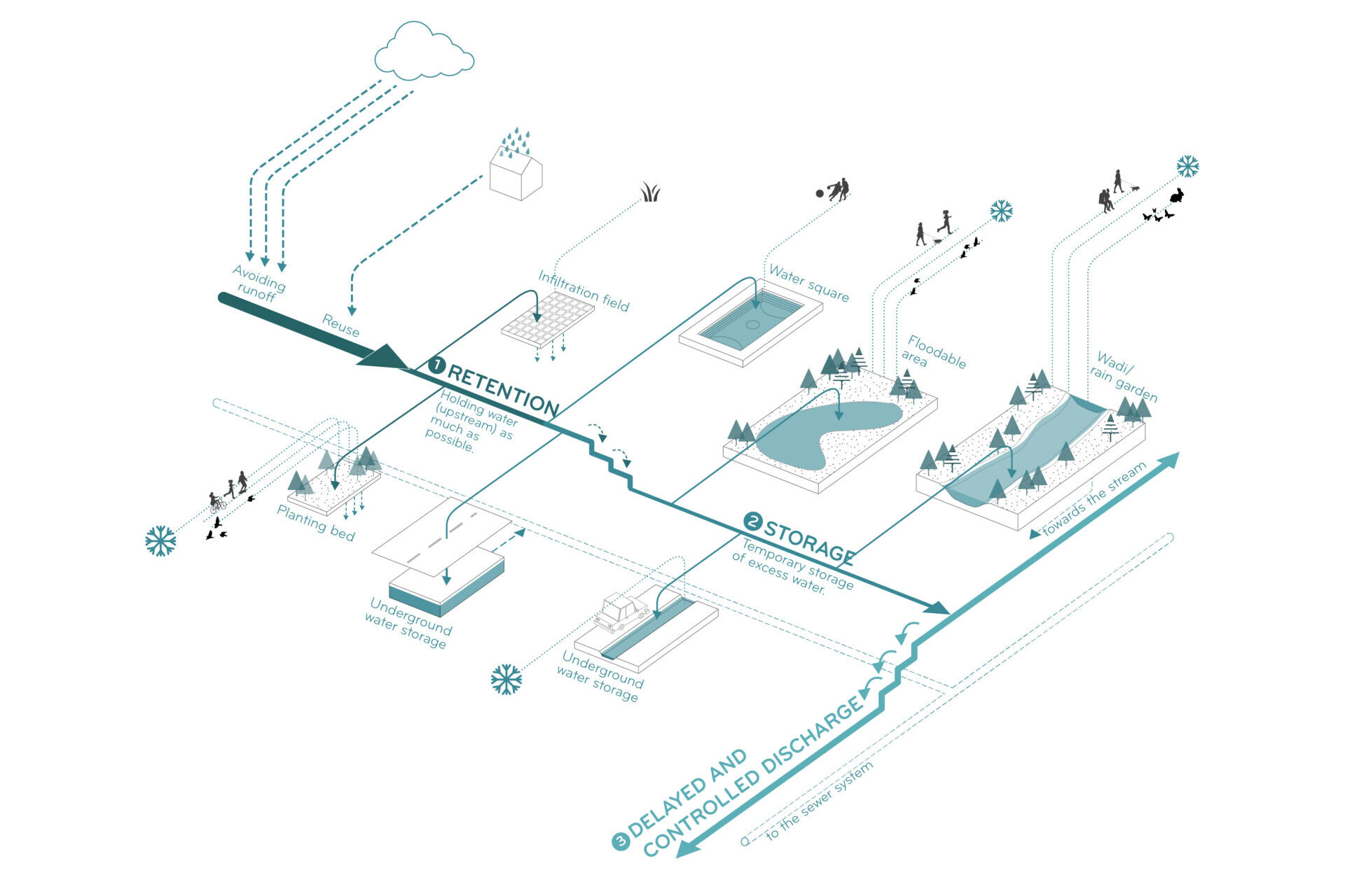
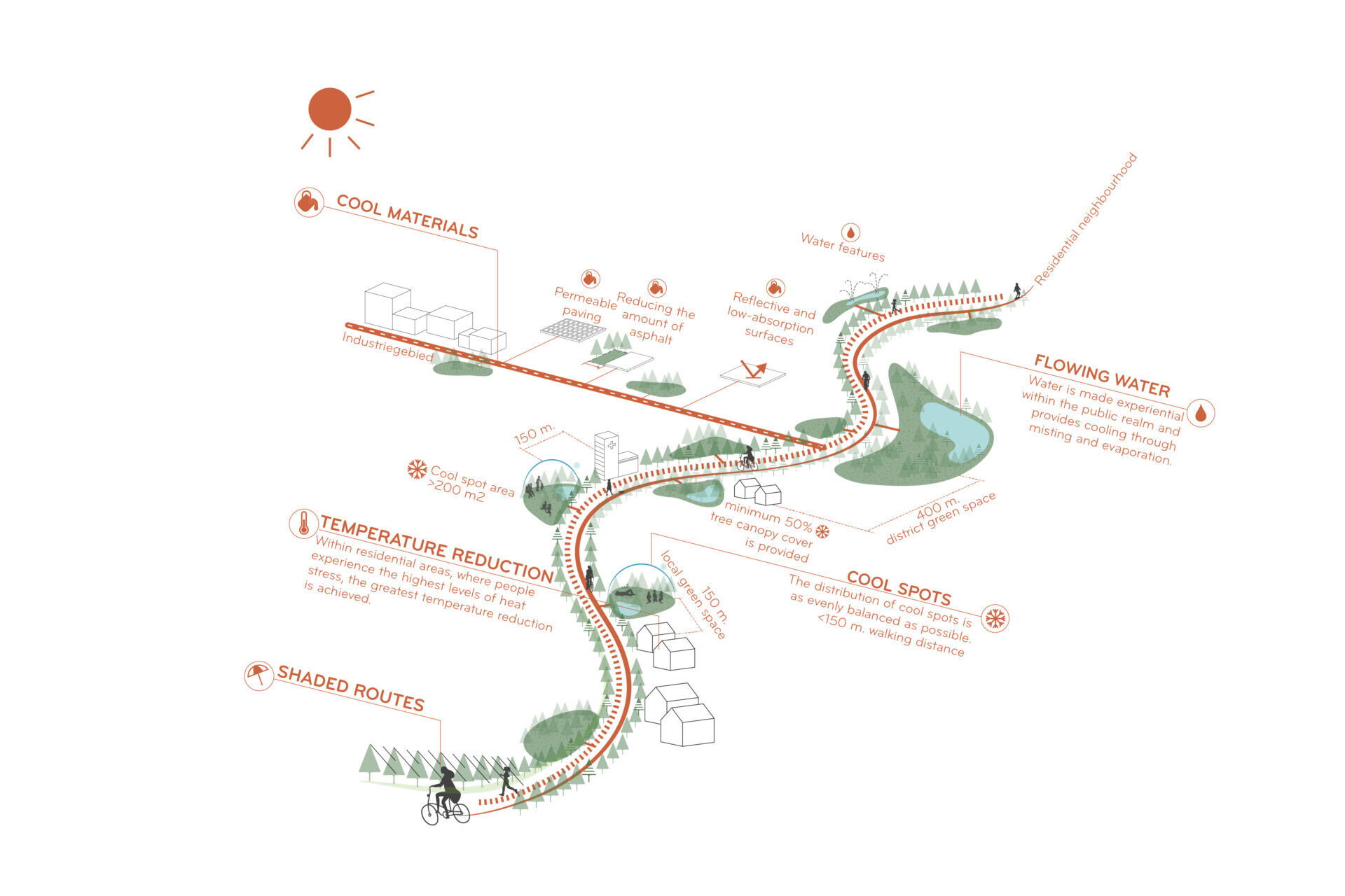
The typical street profile illustrates a comprehensive overview of local measures to manage flooding, reduce heat, and enhance green space, making it easy to select and combine solutions. These measures can be integrated on-site to create targeted, coordinated, multi-benefit, fourfold spatial interventions.

Transforming Nieuwdreef and Maantjessteenweg from paved traffic corridors into blue-green streets creates cooler, climate-adaptive public spaces. Nieuwdreef gains permeable surfaces, layered planting, lush green verges and shade trees along the ‘nerf’ route, while restoring the historic stream along Maantjessteenweg, supported by a linear stream park, adds upstream buffering, reduces flooding and transforms the four-lane road into a biodiversity-rich space.


“The project demonstrates that existing cities can become climate-adaptive by reactivating their origins in water and green infrastructure to shape a new and stronger identity.”
The Water and Green Neighbourhood Plan for Antwerp shows that climate-adaptive measures can be effectively embedded within existing urban structures, enabling climate challenges to be addressed from city to neighbourhood level. Supported by a digital prediction model 3Di, this interdisciplinary design method allows resilience to future climate extremes to be tested and strengthened in a context-specific way. The fourfold climate-adaptation framework translates diverse demands into spatially feasible and locally meaningful solutions, while the toolboxes and blue–green typology enable residents and decision-makers to explore options and participate actively. This manual will guide future street development and support a citywide approach to climate-resilient urban planning.